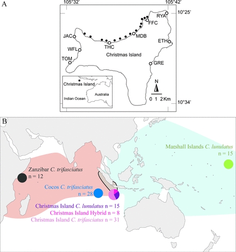
Figure 2.

(A) Map of Christmas Island indicating the position of study sites used for the initial surveys (white dots) and the North coast surveys (black dots); Flying Fish Cove (FFC), Million Dollar Bombie (MDB), Thundercliff (THC), Jackson Point (JAC), Stef's Waterfall (WFL), Toms Point (TOM), Greta Beach (GRE), Ethel Beach (ETH), and Ryan's Ravine (RYA); inset shows the location of Christmas Island in the Indian Ocean. (B) Geographical origin and sample size (n) of populations of Chaetodon trifasciatus, C. lunulatus, and their hybrid used to assess phylogenetic relationships and population structure; the parental species ranges (redrawn from Allen et al. 1998) are also shown: C. trifasciatus (light red shaded area), C. lunulatus (light blue shaded area), and their contact zone (gray area with black outline).
