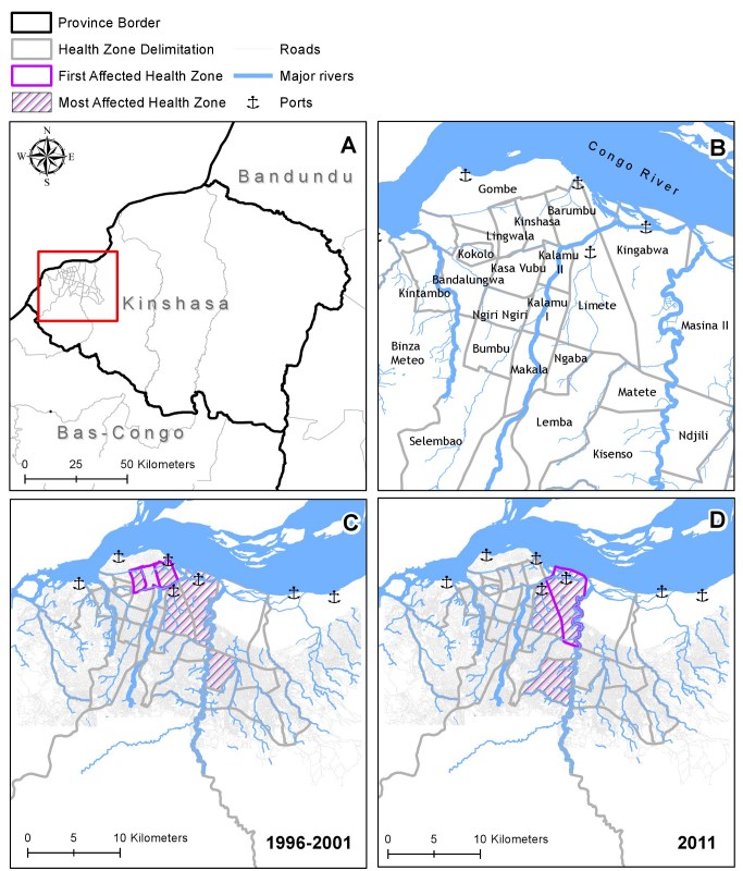
Figure 3. Cholera in Kinshasa: Comparing the Epidemics 1996-2001 and 2011.
The province Kinshasa and its 34 health zones, with the red box indicating metropolitan Kinshasa (A). Cholera affected areas in metropolitan Kinshasa in 1996-2001 (C) and 2011 (D). The health zone names are given in (B), and the 3 major rivers crossing the city (Bitchakutchaku, Kauka, and Ndjili from left to right) as well as the city’s major ports on the shores of Congo River are highlighted.
Disclaimer: Shapefiles were provided by the MoH and MONUSCO. The boundaries and names shown and the designations used on this map do not imply official endorsement or acceptance by the United Nations.

