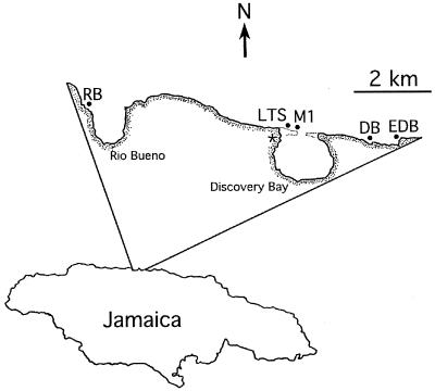
Figure 1.
Map of Jamaica showing the location of the study sites along the north coast. RB = Rio Bueno, LTS = Long Term Survey, M1 = Mooring 1, DB = Dairy Bull, EDB = East Dairy Bull (≈0.7 km east of DB), and * = Discovery Bay Marine Laboratory. Sites were selected to sample reefs that have been the subject of long-term studies [RB, LTS, M1 (refs. 1, 11, 15, and 18)] and recent surveys (DB; ref. 19), and to span the greatest scale accessible with small boats (e.g., EDB).

