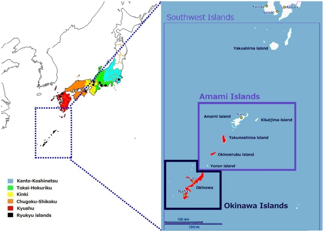
Figure 1. Geographic locations of the populations studied in Japan.
Kanto-Koshinetsu: the eastern-central region of the main island. Tokai-Hokuriku: the central region of the main island. Kinki: the southern-central region of the main island. Chugoku-Shikoku: the westernmost part of the main island and the fourth largest island. Kyushu: the third largest island, located southwest of the main island. The Amami Islands: a part of the Southwest Islands, located southwest of Kyushu. The black circles represent the approximate geographic positions of the enrollment institutions, and the red-colored islands in the enlarged view of Japan's Southwest Islands (right) represent those used for sampling in the J-MICC study (Tokunoshima and Okinoerabu Islands) and in the survey by the PASNP consortium (the Okinawa Islands).

