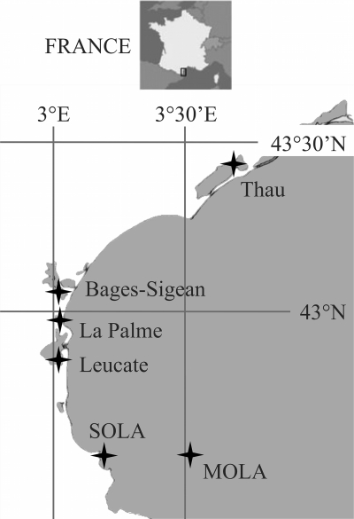
Fig 1.
Locations of sampling sites. Four locations are lagoons (Leucate, 42°48′24″N, 03°01′27″E; La Palme, 42°57′18.04″, 3°0′3.56″E; Bages-Sigean, 43°03′14.76″N, 2°59′51.63″E; and Thau, 43°26′01.40″N, 03°39′54.49″E), and the two others are open-sea stations, one coastal (SOLA, 42°29′18″N, 3°8′42″E) and one offshore (MOLA, 42°27′11″N, 3°32′36″E). SOLA is a marine station included in the French marine monitoring network SOMLIT.

