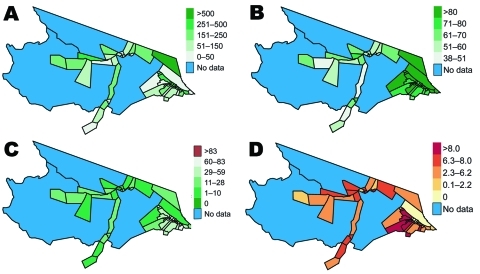
Figure 4.
Cloropleth maps of selected malaria risk factors for health districts in Mâncio Lima, Brazil. A) Resident population in health districts in 2006. B) Percentage of slide-confirmed malaria cases receiving access to care within the first 48 hours of symptom onset in 2006. C) Percentage of 1997 deforestation in each of the health districts calculated from 60 × 60-meter resolution classified PRODES data. D) Cumulative percentage change in deforestation by health district from 1997 to 2006. Uninhabited areas are excluded from the analysis.

