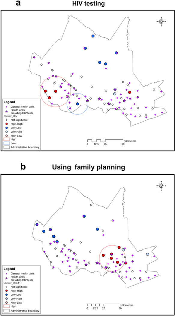
Fig. 4. Local Cluster Maps.
The circles are clusters from spatial scan statistic, where red circles are high value clusters and blue circles are low value clusters. The dots are village-level cluster centers from LISA analysis, where red dots are high–high cluster centers and blue dots are low–low cluster centers. (For interpretation of the references to color in this figure legend, the reader is referred to the web version of this article.)

