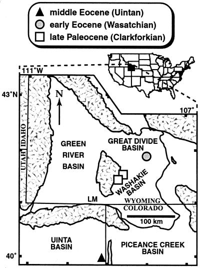
Figure 1.
Sampling areas. Symbols indicate census sites, which total six, with two each within the symbols for the late Paleocene and middle Eocene. Patterned areas are uplifts. Late Paleocene sites: USNM locs. (localities) 41270, 41.5658°N, 108.5765°W, and 41300, 41.4605°N, 108.6988°W, Fort Union Formation, Washakie Basin. Early Eocene sites: USNM locs. 41342, 41.9263°N, 107.9899°W, and 41352, 41.9091°N, 107.9951°W, Wasatch Formation, Great Divide Basin. Middle Eocene sites: DMNH locs. 323 and 1732, both 39.9411°N, 109.1347°W, Green River Formation, Uinta Basin. LM, Little Mountain flora (Bridgerian), mentioned in the text (39). “Clarkforkian,” “Wasatchian,” “Bridgerian,” and “Uintan” are successive North American land mammal “ages” (biozones) (42). See ref. 39 for additional locality information. Redrawn after ref. 39.

