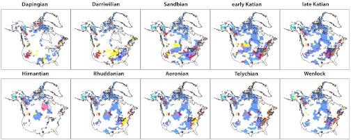
Fig. 1.
Maps of sedimentary rocks deposited across Laurentia from Middle Ordovician (Dapingian) through the Early Silurian (Wenlockian) time. Red points mark PaleoDB collections. Colored polygons indicate sedimentary rock distribution and lithotype. Blue = carbonate, dark blue = mixed carbonate-clastic, gray = fine clastics, tan = mixed clastics, yellow = sand, orange = coarse clastics, blue-green = chert, pink = evaporites, brown = metamorphic indet., dark green = igneous indet. Only the uppermost unit in each column is plotted.

