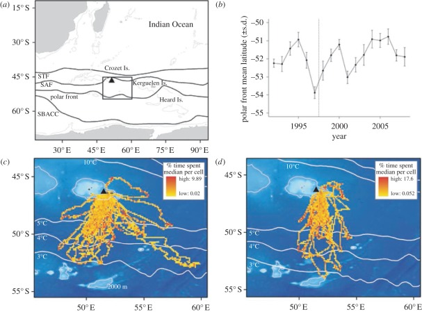
Figure 1.
(a) Map of the study area and king penguins' range (47–60° E, 45–54° S). The mean annual position of the fronts (STF: subtropical front, SAF: sub-Antarctic front and SBACC: southern boundary of the Antarctic circumpolar current) are illustrated following Moore et al. [36] and Park et al. [37]. (b) Time series of the mean position of the 4°C isotherm corresponding to the polar front. The mean latitudinal position (±s.d.) was calculated for February within king penguins' longitudinal range (47–60° E). (c,d) Observed habitat use of king penguins tracked from 1998 to 2008 during the incubation and brooding period, respectively. Bathymetry and mean annual position of the isotherms (1998–2008) are displayed in the background. Triangle corresponds to Crozet Is.

