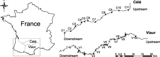
Figure 2.

Map showing the geographical position of the river Célé (the continuous landscape) and the river Viaur (the fragmented landscape). Both rivers belong to the Adour-Garonne basin drainage. This map also shows the sampling sites (black dots) within each river. Weirs (small lines) and hydro-electric dams (large lines in the river Viaur) are also shown. However, note that not all weirs (over 50) are represented on the river Viaur.
