
Figure 1.
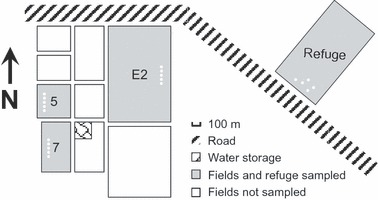
Diagram showing spatial relationships among the uncultivated land (refuge) and the three cultivated fields sampled in the Boggabilla region of New South Wales. White spots in the fields and refuge indicate the source of the plant and soil samples.