Fig. 2.
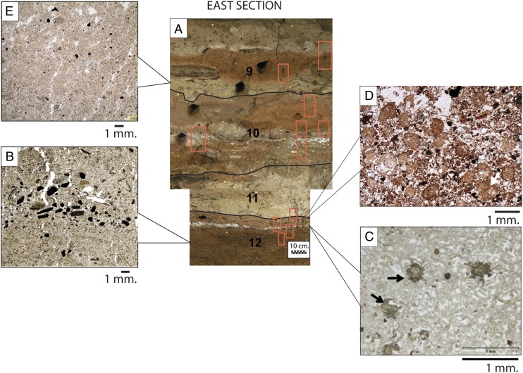
(A) Photograph of the east section in excavation 1 with boundaries between archaeological strata 12 and 9. Numbered boxes indicate location of intact block sampled for microstratigraphic analysis. (Scale bar: 10 cm) (B) Representative micrograph of low-energy, water-bedded silt, sand, and 0.5-cm-thick gravel (lag) from stratum 12. (Scale bar: 1 mm.) (C) Micrograph of microfacies from white layer close to top of stratum 12 composed of diagenetically altered dolostone and flowstone, with nodules of montgomeryite (arrows). (D) Micrograph of reddish-brown, wind-blown silty clay aggregates that comprise several lithological units starting from the top of stratum 12. (Scale bar: 1 mm.) (E) Representative micrograph of wind-blown, fine sand mixed with millimeter-sized bone fragments from tan lithological units in strata 11, 10, and 9. (Scale bar: 1 mm.)

