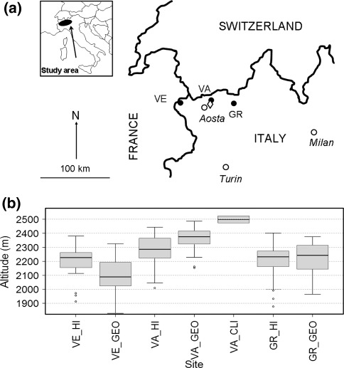
Fig. 1.
Sketch map of the study area. a Treeline altitudes were assessed at the regional scale for three valleys in the Valle d’Aosta region, western Italian Alps: VE Veny, VA Vallpelline–Etroubles, GR Gressoney (black spots). The rhombus indicates the position of the study site Becca di Viou. b Boxplot of the treeline altitude in the three valleys. The treeline altitude was assessed over 240 km by considering the trees growing at the highest altitudes and the most important factor limiting a treeline potential upward shift in the three study valleys by considering human impacts (HI), geomorphologic constraints (GEO) and climate (CLI)

