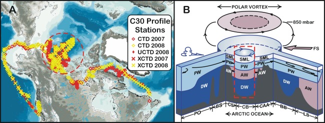
Fig. 1.
a Map of the study area and location of stations occupied by the CCGS Louis S. St-Laurent and CCGS Sir Wilfrid Laurier in 2007 and 2008 as part of the IPY—C3O project and the Canada/USA JOIS. The term CTD denotes a station at which a Conductivity–Temperature–Depth profiler was deployed, while XCTD denotes a station at which an expendable Conductivity–Temperature–Depth probe was deployed. The location of the Canada Basin and Beaufort Gyre is marked by the dotted circle; and b schematic view of the C3O/JOIS area showing the water mass structure of the Arctic Ocean, the exchange of waters with the adjoining subarctic Pacific and subarctic Atlantic Oceans and the overlying atmosphere. PO Pacific Ocean, BS Bering sea, CS Chukchi sea, CB Canada Basin, CAA Canadian Arctic archipelago, BB Baffin bay, LS Labrador sea, PW Pacific water, AW Atlantic water, SML surface mixed layer, DW deep water, FS Fram strait. BS and CS are joined through Bering Strait. The location of the Beaufort Gyre is marked by the red border

