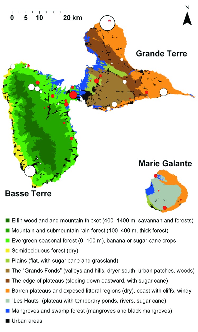
Figure 2.
Ecologic map of Guadeloupe and West Nile virus (WNV)-positive equine centers. Basse Terre (southwest) is mainly mountainous (volcanic, highest point 1,467 m) and wet. Grande Terre (northeast) is flat (mainly <100 m) and dry. Marie Galante is flat (plateaus <200 m) but has more water than Grande Terre. The ecologic map was derived from "Carte écologique de la Guadeloupe," created by Alain Rousteau, University Antilles-Guyane. Equine centers with WNV-seropositive equines are represented by red circles (the size of each circle is proportional to the number of seropositive equines). Centers without WNV-seropositive equines are represented by white circles (the size of each circle is proportional to the number of equines tested). The red asterisk shows a site that contained 3 seropositive equines. All were race horses that travel frequently and thus may have been infected elsewhere.

