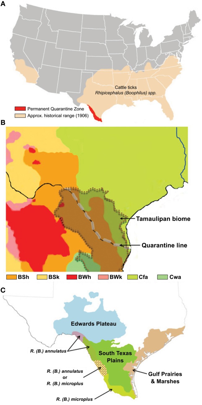
Figure 1.
(A,C) The U.S. distribution of cattle ticks in 1906 depicts the zone of risk for tick re-establishment and the permanent quarantine zone along the Texas–Mexico international boundary and quarantine line (A), as adapted from Graham and Hourrigan (1977); the Tamaulipan biome of the Texas–Mexico border area (Scifres, 1985), indicated by the overlay with dotted boundary (B), is the major ecoregion comprising the quarantine zone that consists of four Koppen–Geiger climate classifications, as adapted from Peel et al., 2007, where the majority of the biome is of an arid-steppe (BSh) classification linked with the Temperate (Cfa) classification that extends throughout the historical range of cattle fever ticks, whereas in Mexico the biome includes small areas with climate generally classified as Arid desert (BWh) or Temperate (Cwa); the distribution of ecoregions, as adapted from Correll and Johnston (1970), reflects the diversity of ecological and environmental resources (C), and is integrated with an overlay showing the quarantine zone distribution of recorded incursions of R. annulatus and R. microplus, as adapted from Lohmeyer et al. (2011).

