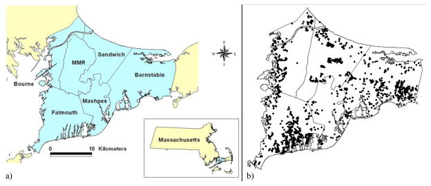
Figure 1.
Map of Cape Cod, Massachusetts and distribution of geographic locations of example data on Upper Cape Cod
Figure 1a) displays a map of Upper Cape Cod, Massachusetts. Figure 1b) illustrates the distribution of geographic locations (with jigger) of observations in the example data across Upper Cape Cod.

