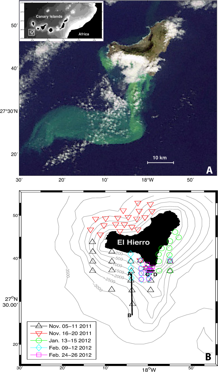
Figure 1.
(A) Natural color composite from the MEdium Resolution Imaging Spectrometer (MERIS) instrument aboard ENVISAT Satellite (European Space Agency), (November 9, 2011 at 14:45 UTC). Remote sensing data have been used to monitor the evolution of the volcanic emissions, playing a fundamental role during field cruises in guiding the Spanish government oceanographic vessel to the appropriate sampling areas. The inset map shows the position of Canary Islands west of Africa and the study area (solid white box). (B) Location of the stations carried out from November 2011 to February 2012 at El Hierro. Black lines denote transects A-B (Figure 3) and C-D (Figure 5).

