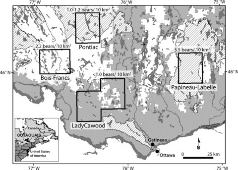
Figure 1.

The study area located in Outaouais, Québec, Canada (approximately 46°N, 76°W), was divided into four sampling areas (dark polygons): Pontiac, LadyCawood, Bois-Francs, and Papineau-Labelle. White and light grey areas denote public and private properties, respectively. Dashed areas indicate delegate management territories.
