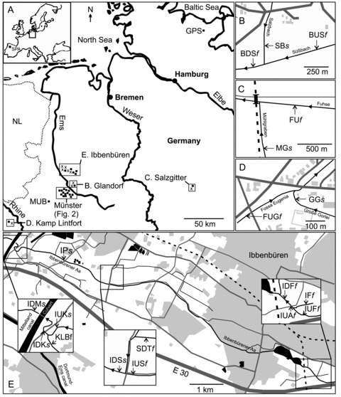
Figure 1.

Sampling locations. (A) Sampling sites in North West Germany (▪, saltwater; ×, freshwater) and outgroups GPS and SPA (insert map). (B–E) Detailed maps of freshwater (f) and sampling locations with salt water influence (s). (B) Natural salt water inflow from a salty spring (SBs∼ 10,000 µS cm–1). (C) Salt pollution from potash mining (MGs∼ 4000 µS cm–1). (D, E) Salt pollution from coal mining (GGs∼ 6000 µS cm–1; IDMs, IUKs, IDKs, IPs, IDSs∼20,000 µS cm–1). For abbreviations of sampling sites see Table 1. Legend of detailed maps: housing scheme (light gray), streets (dark gray), railway (dashed line), surface water (black), sewage plant (black circles). Figures are modified maps from TIM-online.
