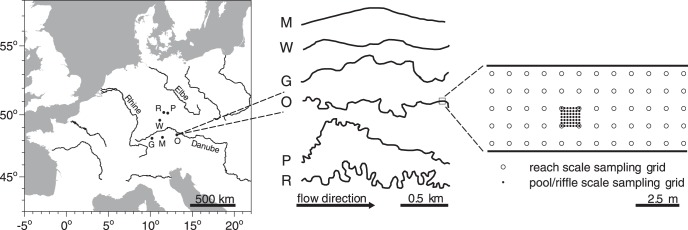
Figure 1. Map and sampling design of the investigated stream reaches.
Map of Central Europe comprising the locations of the investigated stream reaches (left panel), their plan view morphologies 2 km upstream of the sampled reach (middle) and a scheme of the nested sampling design (right panel). Open symbols in the right panel denote the reach scale grid (distances of 1 m), closed symbols denote the pool/riffle scale grid (distances of approx. 17 cm). Codes for the stream reaches are M = Moosach, W = Wiesent, G = Guenz, O = Grosse Ohe, P = Perlenbach, R = Suedliche Regnitz.

