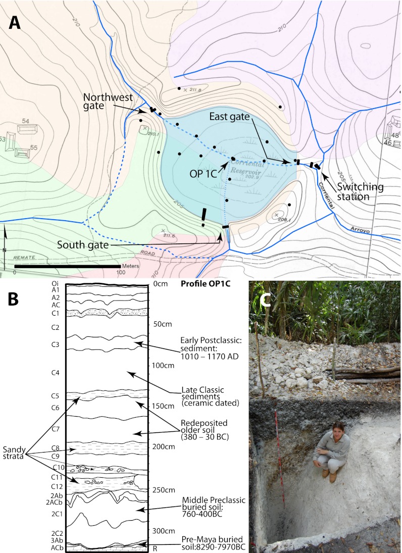
Fig. 5.
Corriental Reservoir depictions. (A) Plan map. The principle catchment is to the northwest, with the northeastern catchment diverted away from the reservoir during the Classic Period. (B) Profile of the sediment control unit for correlating coring operation; dates in the brackets are from core 8 (Fig. S7A). (C) Canal exposure (OP 1G) (Fig. S7A). The base map is courtesy of the Penn Museum (16).

