
Figure 2. Map of Cape Town indicating the main areas in which the mobile services operated.
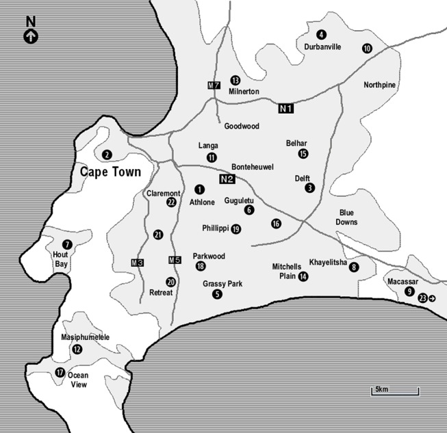
(1) Athlone: testing at a shopping mall/market, the roadside, a social housing project; (2) Cape Town city bowel: testing at a college, service for homeless, service for commercial sex workers, two companies, two road sides; (3) Delft: testing at two squatter camps, two clinics, two social housing projects, the road side; (4) Durbanville: testing at two taxi ranks; (5) Grassy Park: testing at the road side; (6) Guguletu: testing at two shopping malls/markets, a clinic; (7) Hout Bay: testing at a school, in a township, at the harbour; (8) Khayelitsha: testing at a shopping centre/market, a school, in the township, at the station; (9) Macassar: testing at the road side; (10) Kraaifontain: testing at a clinic; (11) Langa: testing at a shopping mall/market, the road side; (12) Masiphumelele: testing in the township, at a shopping mall; (13) Milnerton: testing at a company; (14) Mitchells Plain: testing at the road side, a social housing project; (15) Belhar: testing at a squatter camp; (16) Nyanga: testing at a taxi rank, at a shopping centre; (17) Ocean View: testing at a clinic, in the township; (18) Parkwood: testing at two road sides; (19) Phillippi: testing at two farms, three road sides; (20) Retreat: testing at a clinic; (21) Wynberg: testing at the road side; (22) Claremont: testing at the road side; (23) Grabouw: testing in the township, at the clinic, at the road side.