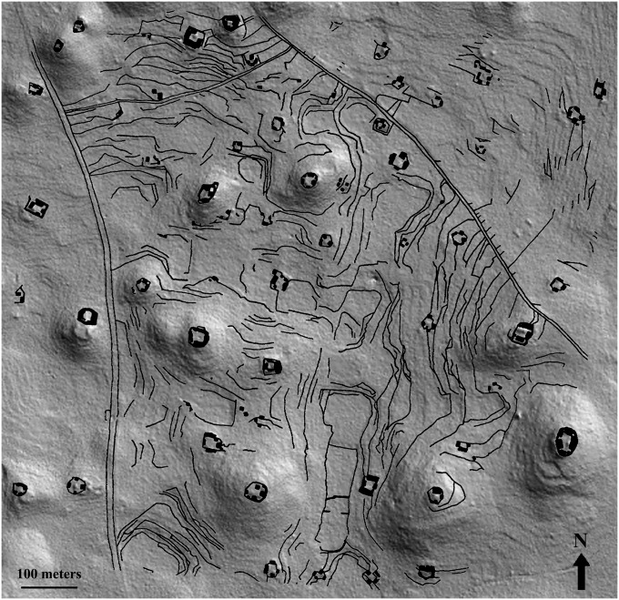
Fig. 3.
Previously mapped square-kilometer area of Caracol settlement and terraces superimposed on a 2D hillshade of the LiDAR DEM, showing congruence. Causeways are visible to either side; residential groups were mapped throughout the square kilometer, but before the LiDAR survey agricultural terracing was recorded systematically only between the two causeways.

