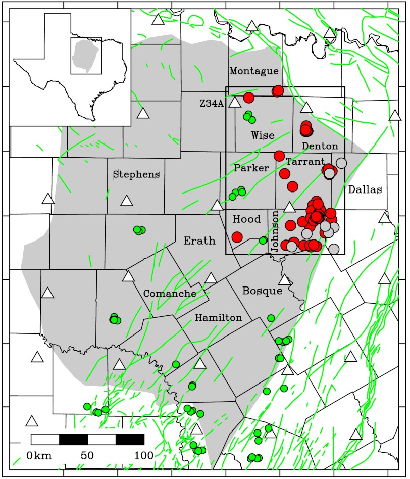
Fig. 1.
Map of Barnett Shale study area; the inset and rectangle at upper left show the area in Texas included in this map. Triangles are locations of USArray temporary seismic stations, red circles are earthquakes located in this study (Table S1), green circles are quarry blasts located in this study, and white circles are epicenters reported by the NEIC during study interval (Nov 15, 2009 to Sept 15, 2011). The gray shaded area is approximate extent of the Barnett Shale; green lines are mapped faults (18); black lines are boundaries of Texas counties; labels indicate names of counties mentioned in the text. Dallas and Fort Worth are situated in Dallas and Tarrant Counties, respectively; the town of Cleburne is in Johnson County. The rectangle in the Upper Right of figure indicates region mapped in Fig. 2.

