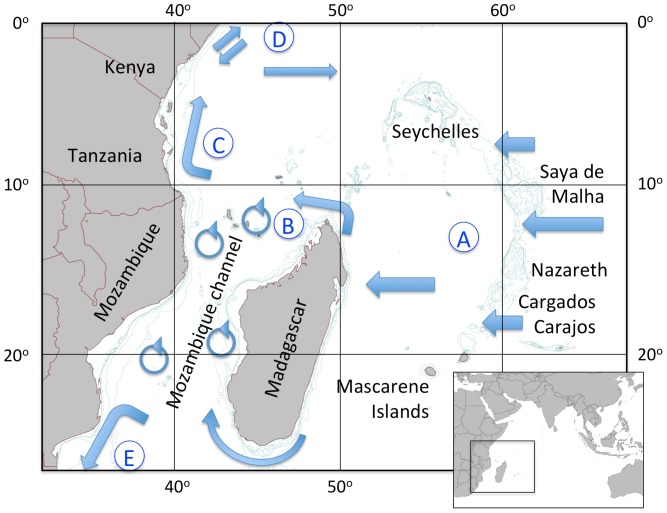
Figure 1. The Western Indian Ocean, defined by the East African coast and the Saya de Malha, Nazareth and Cargados Carajos banks of the Mascarene Plateau.
The principal currents that define the region are coded by the circled letters A–E (see Table 1). Bathymetric contours were selected to illustrate the main plateau and bank features, at 60, 200 and 1000 m depth.

