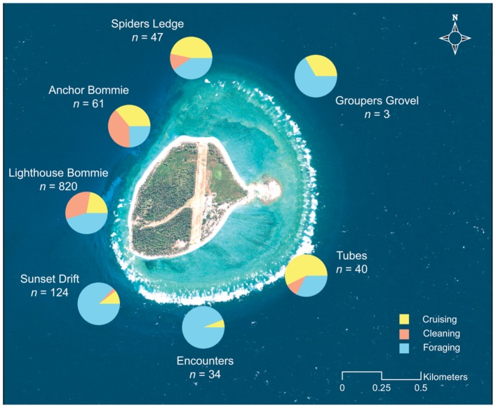
Figure 5. Habitat use for manta rays at Lady Elliot Island.
Map of Lady Elliot Island showing total observations of M. alfredi at seven sites around the reef, between May 2008 and May 2011. Pie charts indicate percent activity at each site for cruising, cleaning and foraging manta rays. High-resolution image of LEI obtained from the Quickbird orbiting satellite (Geoimage Pty Ltd., www.geoimage.com.au) and data overlaid using ArcGIS 10 (ESRI, www.esri.com/software/arcgis).

