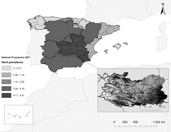
Figure 5.
Situation of bTB herd prevalences in Spain in 2007. Autonomous Communities are marked in dark lines. In detail, the 102 municipalities of Ciudad Real (black lines), displayed in 113 polygons (because some municipalities are divided into several parts). The altitude of the province (ranging from 350 to 1261 m) is represented in a colour ramp (white to black); the highest areas are the Toledo Mountains (in the North), Sierra Morena (in the Southwest) and the southern part of the Central Plateau (in the East).

