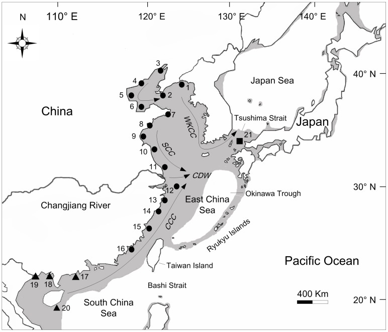
Figure 1. Map of East Asia showing the sampling sites of Cyclina sinensis and the coastal currents in summer.
Populations are labelled with numbers as shown in Table 1. Different symbols are used to represent populations from three marginal seas: circles, East China Sea populations; triangles, South China Sea populations; square, Japan Sea population. Shaded sea areas indicate regions < 120 m depth that would have been exposed during periods of low sea level. WKCC, West Korea Coastal Current; SCC, Subei Coastal Current; CCC, China Coastal Current; CDW, Changjiang diluted water.

