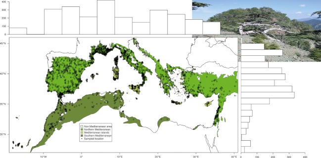
Figure 1.
Map of the Mediterranean Basin showing the eco-climatic envelope as defined by Olson et al. (2001) and the geographic partition (North vs. South vs. islands) tested in our study. Each black circle represents a location sampled in the meta-analyzed raw studies. Histograms for latitudinal and longitudinal distributions of locations sampled in raw studies are given above and to the right of the map. The photographed tree in the upper right corner is a Cedrus brevifolia individual on a ridge in its natural habitat of the Trohodos mountains of Cyprus.

