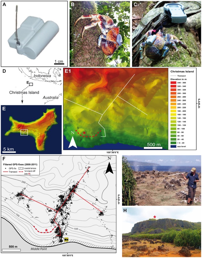
Figure 1. Animals and tags.
A: Photograph of the e-obs GPS-tag (2nd tag version with single battery used in 2010 and 2011). B Tagged Birgus latro escaping into a tree (1st tag version with twin batteries used in 2008). C Tagged B. latro (2nd tag version) inspecting the BaseStation for wireless data download (image kindly provided by Meike Kilian). D Location of Christmas Island, Indian Ocean. E, E1 Geo-referenced 3D model of Christmas Island showing the study area at Aldrich Hill and the transect. F Topographic map displaying the filtered data set of 9,272 GPS fixes recorded in all three expeditions. The camera symbol shows the position from which G and H were taken. G, H Photographs of the coastal terrace. G shows the first author tracking radio signals near the blowholes which can be identified by the three spray plumes in the background (image kindly provided by Meike Kilian). H is taken facing north-west and the photo shows the rocky coastal terrace, the dense belt of Pandanus and in the background the vertical first inland cliff. For positions of asterisk, see F.

