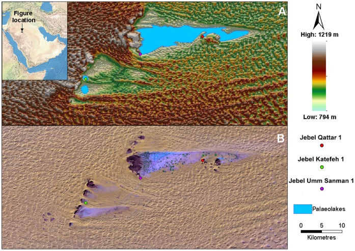
Figure 1. Location, topography and geomorphology of the Jubbah region.
(A) Shuttle Radar Topography Mission Digital Elevation Model of the Jubbah region, overlain with interpreted palaeolake extents in blue. (B) Landsat ETM false color composite (bands 7, 4 and 1 on red, green and blue) of the Jubbah region, with exposed paleolake sediments appearing as the lightest blue shades, the rock outcrops as black, and the sand dunes light yellow. Both figures show the locations of the Middle Paleolithic sites identified during reconnaissance and discussed within the text.

