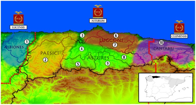
Figure 1. Map of the current territorial division of Asturias, coupled with the political state in the time of the Roman Empire.
Numbers and internal lines indicate the regions from which samples were collected in the present study (1: EoNavia; 2: Narcea; 3: Aviles; 4: Central Oviedo; 5: Southern Oviedo; 6: Gijon; 7: Eastern Oviedo; 8: Nalon; 9: Caudal; 10: Oriente). Coloured bubbles represent the known extension of the most important pre-Roman tribes, according to archaeological, historical and epigraphic sources (see text). Names under imperial vexilla represent the Roman subprovincial division (“conventus iuridicus”), with its precise borders marked with a red dotted line. Also, a small political map of Iberia is shown in the lower right. Asturias is shaded in black while other communities on the northern third of the Peninsula are shaded in gray.

