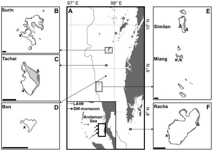
Figure 1. Location of sample sites, Andaman Sea, Thailand.
A) Map of the study area in the Andaman Sea off-shore the west coast of Thailand with inset showing the Andaman Sea from the Nicobar Islands Arc to the southeast Asian mainland of Burma and Thailand (Mainland: Wessel and Smith [79], Bathymetry: Smith and Sandwell [80]). B–F) Close-up maps of the study islands (Surin, Tachai, Bon, Similan, Miang and Racha) with sampling sites (UNEP Coral Millennium Project). Crosses: core sampling sites with high-resolution temperature monitoring and framework height determination (at Miang W and Surin W additional CTDs were deployed) ; triangles: sites where only framework height was measured (Tachai E and Racha E the present study, Similan E and W framework height derives from [16]). Scale bar represents 1 km.

