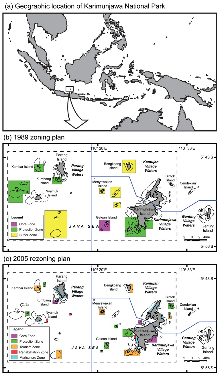
Figure 1. Map of Karimunjawa National Park, Indonesia.
A. Map of Indonesia showing geographic location of Karimunjawa National Park. B. Map of Karimunjawa National Park showing the 1989 zoning plan. C. Map of Karimunjawa National Park showing the 2005 zoning plan that was legislated mid-2005. In total the park contains 22 islands and the surrounding marine environments fall within the different zone designations. Core and Protection zones are no-take zones, the distinction being that entry is permitted in Protection zones. Utilisation zones are the marine waters within the KNP boundary that are not contained within any of the other management zones.

