
Figure 1. Map of mean annual dengue fever incidence rates in districts of Cambodia.
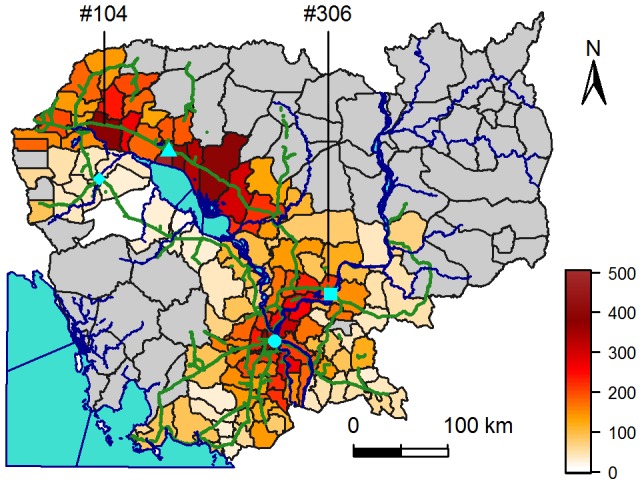
Mean annual incidence rates (in number of cases declared per 100,000 people per year) are calculated over 2002 to 2008, for districts with more than 20 people per km2. Cambodia is surrounded by the Indian Ocean (bottom left), Thailand (West), Lao (North) and Vietnam (East and South-East). Phnom Penh, the capital, is represented by a circle, Siem Reap by a triangle, Kampong Cham by a square and Battambang by a lozenge. Blue lines represent the Mekong River, going north to south, and the Tonle Sap River linking the Tonle Sap central Lake to the Mekong River. Green lines represent national roads. Grey districts have less than 20 people per km2.