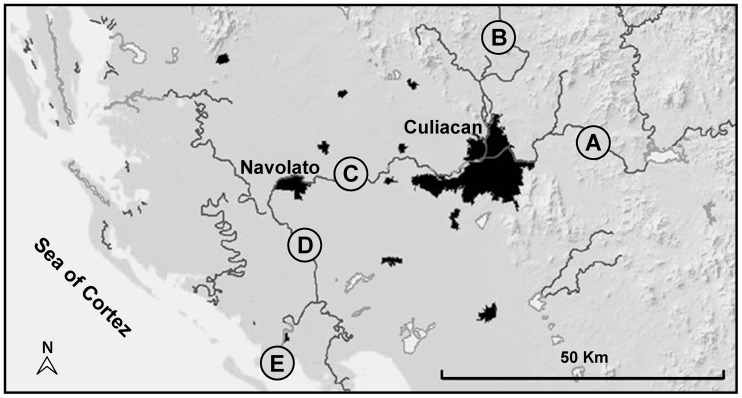
Figure 1. Sampling sites in the Culiacan Valley in Northwest Mexico.
Map of the five sampling sites, Jotagua (A), Agua Caliente (B), Cofradia de Navolato (C), Iraguato (D), and El Castillo (E) that were selected to be 14–38 km apart and to represent the study area in the Culiacan Valley, Sinaloa, Mexico. Dark areas in the map indicate urban zones with more than 20,000 inhabitants. Scale bar corresponds to 50 km.

