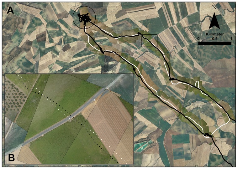
Figure 1. Track of a lesser kestrel foraging flight over the images obtained by an unmanned aerial system.
A White and black tracks correspond to unmanned aerial system and lesser kestrel flights, respectively. The circle indicates the hunting area. The rectangle indicates the enlarged area in B. B High resolution images showing sunflowers, olive trees, road and harvested cereal fields.

