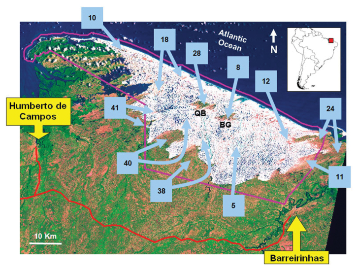
Figure 2.
Satellite image Landsat showing sample sites (light blue arrows) in the region of the Lençóis Maranhenses National Park, Maranhão State, Northeastern Brazil. The amount of sampling days is specified inside light blue squares. Two arrows linked to the same squares and pointing to different places indicate that the sampling effort in the square is divided between these sites. White areas with blue spots are sand dunes and freshwater lagoons, respectively. The greenish areas flecked by the orange color, are restingas habitats (green represents shrubby areas and orange most opening areas). QB and BG indicate the position of the isolated restingas called Queimada dos Britos and Baixa Grande, respectively. The violet line indicates the territory of LMNP. The red line is the road that accesses the park (MA-402). The location of the provinces Barreirinhas and Humberto de Campos are provided in the yellow rectangles. The position of the park in South America is provided upper right. Satellite image modified after Castro and Piorski (2002).

