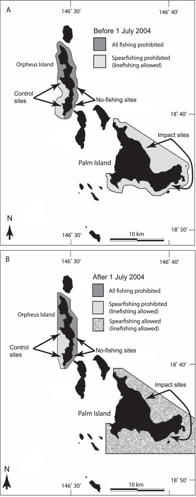
Figure 2. Maps showing the spatial arrangement of fishing zones before (A) and after (B) 1 July 2004.

Arrows show the approximate locations of survey sites within ‘no-fishing’, ‘control’ and ‘impact’ zones. The no-fishing zone (north and east Orpheus Island) has been protected from all forms of fishing since 1987. The control zone (south-west Orpheus Island) has been protected from spearfishing since 1987. The impact zone (Palm Island) was protected from spearfishing from 1987 to 1 July 2004, but spearfishing was allowed from 1 July 2004 onwards. Linefishing was allowed at control and impact zones before and after 1 July 2004. For clarity, other multi-use management zones in the Palm archipelago are not shown (see www.gbrmpa.gov.au for further information).
