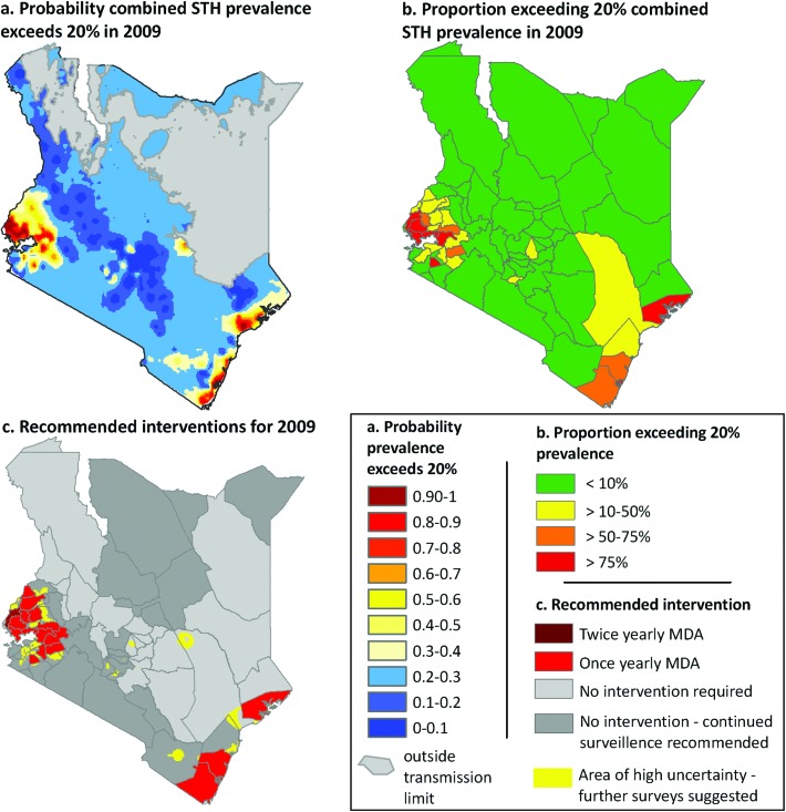
Fig. 3.
An example of the practical applications of a model-based geostatistical (MBG) predictive mapping of soil-transmitted helminths (STH). (a) Bayesian space-time geostatistical models were developed for each STH species using survey data from 1980–2009, and were used to interpolate the probability that combined infection prevalence exceeded the 20% level defined by the World Health Organisation as a mass drug administration (MDA) threshold in 2009. (b) Population census data were overlaid with the probability models to estimate the proportion of the population at risk (i.e. >50% probability of exceeding 20% prevalence threshold) and requiring treatment in 2009 for each district. Recommended intervention districts (c) are defined as: once yearly mass drug administration (MDA), at least 33% of the district exceeds 20% prevalence threshold, and twice yearly MDA, at least 33% of the district exceeds a 50% prevalence threshold. Continued surveillance is recommended for districts where historically >75% of the district exceeded the 20% prevalence based on predictions for 1999, and areas of high uncertainty are those where we can only be 50–65% certain that prevalence is lower than 20%. Adapted from Pullan et al. 2011.

