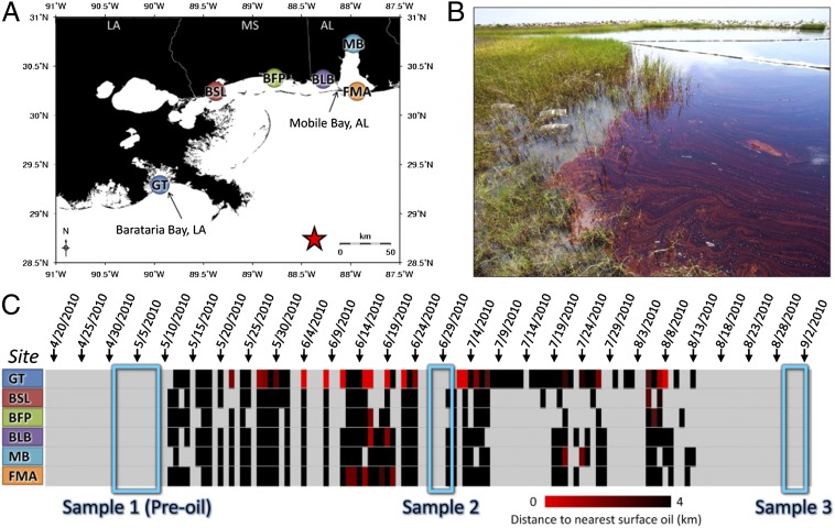
Fig. 1.
Location of field study sites and incidence of oil contamination. (A) Location of field sampling sites, which include Grand Terre (GT), Bay St. Louis (BSL), Belle Fontaine Point (BFP), Bayou La Batre (BLB), Mobile Bay (MB), and Fort Morgan (FMA). Color coding is consistent with other figures. The red star indicates the DWH spill site. (B) Photograph (by A.W.) of the GT field site on June 28, 2010, showing contaminating oil and minnow traps in the marsh. (C) Proximity of nearest surface oil to each field site was determined by SAR, where rows are field sites and columns are days. Light gray represents no data, and black represents the nearest surface oil at a distance of >4 km; the increasing intensity of red indicates closer proximity of oil. Three field sampling trips are highlighted (blue boxes). BSL; BFP; FMA.

