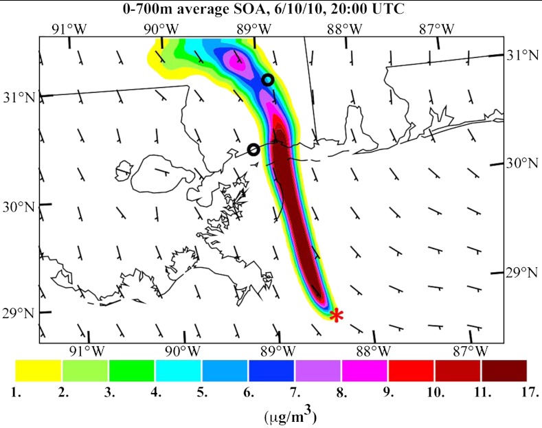
Fig. 8.
Prediction at the surface of the average SOA contribution from the DWH oil spill for 20:00 Coordinated Universal Time (UTC) (3 pm local time), June 10, 2010. The red asterisk shows the DWH spill site location. The small black circles are the locations of the Gulfport (coastal MS) and Oak Grove (inland MS) SEARCH monitoring sites.

