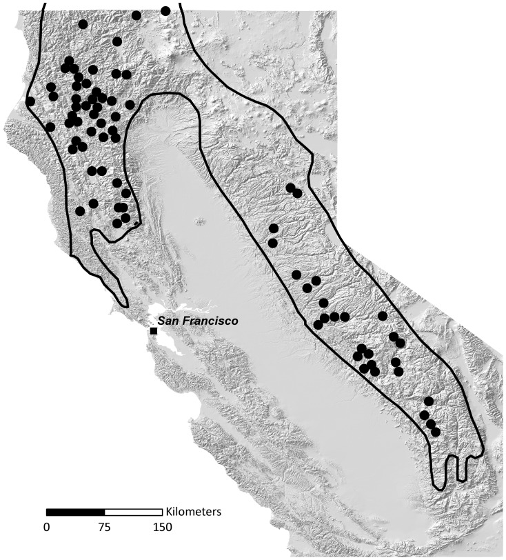
Figure 1. Historical range map for fisher in California.
Fisher locations used by Grinnell et al. [26] to document the distribution of fisher in California. Locations are based primarily on reports of trappers and collecting expeditions from 1919–1924. Grinnell wrote that “spots [black dots] indicate, almost all of them with certainty, the locality of capture; probably some indicate the residence of post office or trapper”. The outlined area is the Grinnell et al. [26] assessment of the range of fisher in California from ∼1850–1925.

