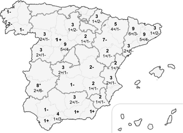
Figure 1.
Geographical distribution of the sampled pig farms (n = 100) throughout Spain. The regions are delimited by dark grey lines and their provinces are delimited by light grey lines. The numbers in boldface indicate the total number of farms sampled at the indicated province, and the occurrence or absence of recent diarrheic outbreaks in the sampled farms is indicated by a “+” (n = 47) or “-” (n = 53) symbol, respectively. The asterisk symbol (*) indicates the only 8 sampled locations where pigs were raised outdoors.

