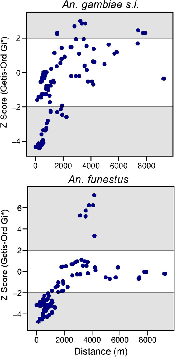
Figure 6.

Scatter plots comparing the spatial clustering of Anopheles gambiae s.l. and Anopheles funestus densities with distance from the village centre. Spatial clustering is represented by the species specific Getis-Ord Gi* Z Score calculated for each household; clusters of households with high densities were identified with Z scores >1.96 (shaded area at top), or vice versa, clustered households with low densities of anophelines were identified with Z scores < −1.96 (shaded area at bottom).
