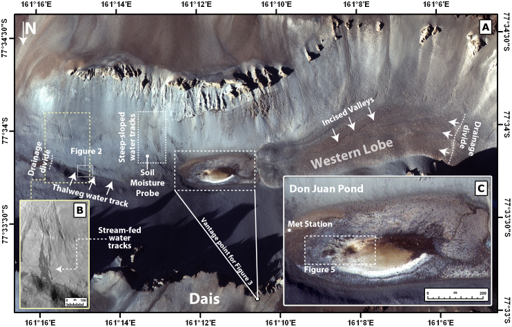
Figure 1.
(A) Don Juan basin in the South Fork of Upper Wright Valley, McMurdo Dry Valleys, Antarctica.Don Juan Pond is found at the lowest point of the basin. The pond is bounded by steep (~30°) slopes to the north and south, a debris-covered lobe to the west, and colluvium-mantled terrain to the east, where the most prominent water tracks are observed. IKONOS orbital color image, acquired on February 1, 2009. (B) The eastern-most channels within Don Juan basin. When active, these channels produce water tracks at their termini that connect to the water track on the thalweg east of Don Juan Pond (Figure 2). IKONOS orbital pan-chromatic image, acquired on January 31, 2003. (C) Inset of Don Juan Pond on February 1, 2009.

