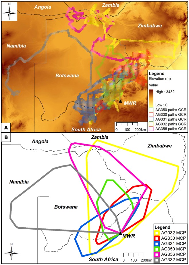
Figure 1. Foraging ranges represented by (A) path GCRs and (B) MCPs for six immature African white-backed vultures.
Path GCRs (A) represent 10×10 km grid cells intersected by a continuous line between all consecutive GPS locations recorded during the total tracking period of each vulture. MCPs (B) were created by connecting the outermost GPS locations recorded for each vulture. Mankwe Wildlife Reserve capture site is indicated by a black triangle and “MWR”.

