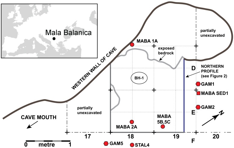
Figure 1. Location of the site and the distribution of samples in the cave.
Upper left panel: location of Mala Balanica in southwestern Europe. Right panel: plan of Mala Balanica indicating excavated areas superimposed on the excavation grid square identifiers (D, E, F, 17, 18, 19), and locations of dated teeth, sediment, and speleothem samples, and in-situ gamma measurement locations (GAM). Note position of northern profile here (in blue), which is depicted in Figure 2.

